
📊 Full opportunity report: The Eye Over The City: How Wide-Area Motion Imagery Works — And Where It Goes Blind on ThorstenMeyerAI.com — validation score, market gap, and execution plan.
TL;DR
Wide-Area Motion Imagery (WAMI) captures entire cities in real-time, enabling detailed tracking and forensic analysis. It is a key surveillance tool with growing integration of AI, but faces physical and operational limits.
Wide-Area Motion Imagery (WAMI) is transforming surveillance by allowing a single sensor to monitor entire cities simultaneously, recording all movement for real-time and retrospective analysis. This technology is increasingly deployed in military, border security, and civilian applications, raising significant governance questions.
WAMI systems use an array of cameras to produce gigapixel images that cover several square kilometers, capturing every vehicle and pedestrian in view. The imagery is archived, enabling analysts to rewind and trace movements back to their origins, effectively creating a ‘city-sized’ time machine. DARPA’s ARGUS-IS, a notable example, employs 368 cameras to generate 1.8 gigapixel images, capable of resolving objects as small as six inches from approximately 17,500 feet altitude.
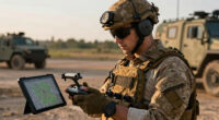
The processing pipeline involves stabilizing the captured image, detecting moving pixels, tracking objects across frames, and archiving data for later review. Due to the enormous data rates, real-time human monitoring is impractical, making automation and AI essential components of WAMI systems. These sensors are mounted on various platforms, including aircraft, drones, and tethered aerostats, expanding operational flexibility.
Historically, WAMI’s origins trace back to early 2000s projects like Lawrence Livermore’s Sonoma program, with deployment in Iraq through the Army’s Constant Hawk system, and later, on Reaper drones in Afghanistan. Its applications have since expanded beyond military use to include wildfire mapping, disaster response, and border security, demonstrating its versatility.
The eye over the city: how Wide-Area Motion Imagery works — and where it goes blind
A normal drone sees through a soda straw. WAMI watches an entire city at once, tracks every mover, and records it all for forensic rewind. Immense reach — with hard limits that make radar and AI its necessary partners.
- City-scale motion, fine detail
- Forensic rewind
- Cloud / smoke / dark degrade it
- Needs a platform loitering overhead
sensing
+ AI
- Sees through cloud & total dark
- Tasked over denied airspace
- Persistent, wide-area from orbit
- Sovereign · on-prem · air-gap
The same archive that traces a bomber to a safe house can trace anyone home — retroactively, without prior suspicion. Baltimore’s secret 2016 deployment led to a 2021 federal ruling that persistent aerial tracking violated the Fourth Amendment. The security value is real; so is the mass-surveillance risk. Who owns the sensor, the archive, and the AI is the accountability question.
WAMI’s power is the archive and the AI reading it; its weakness is weather, airspace, and oversight. The mature posture isn’t optical-vs-radar or capability-vs-liberty — it’s layered sensing (optical WAMI + all-weather SAR), AI-enabled exploitation, and sovereign, auditable control of the whole chain. WAMI shows what a persistent eye can do with clear skies and owned airspace; for the cloud, the night, and the denied area, the radar layer is where the resilient coverage lives.
Implications of WAMI for Surveillance and Privacy
WAMI’s ability to monitor entire urban areas continuously offers unparalleled surveillance capabilities, enhancing security and law enforcement efforts. However, it also raises critical privacy and governance concerns, as the technology can track individuals and vehicles over large areas without their knowledge. The integration of AI further amplifies these issues, making oversight and regulation vital to prevent misuse.

Google Nest Cam Indoor (Wired, 3rd Gen) – Security Camera – 2025 – Snow
Meet the smarter, sharper wired Google Nest Cam Indoor; with 2K HDR video and Gemini, it knows what…
As an affiliate, we earn on qualifying purchases.
As an affiliate, we earn on qualifying purchases.
Evolution and Deployment of WAMI Technologies
Since its inception in the early 2000s, WAMI has transitioned from experimental prototypes to widespread operational systems. DARPA’s ARGUS-IS set a technological benchmark, followed by deployment on military drones and aircraft. Its expansion into civilian sectors, such as wildfire mapping and disaster response, underscores its growing importance. Simultaneously, the limitations of optical sensors—such as weather dependence and platform requirements—highlight the need for complementary modalities like synthetic aperture radar (SAR), which can operate under adverse conditions and over denied areas.
“WAMI’s combination of wide coverage and detailed forensic capability makes it a game-changer in surveillance, but it also demands careful governance.”
— Thorsten Meyer, AI expert
wide-area motion imagery system
As an affiliate, we earn on qualifying purchases.
As an affiliate, we earn on qualifying purchases.
Unresolved Challenges and Limitations of WAMI
While WAMI’s capabilities are impressive, its reliance on optical sensors makes it vulnerable to weather conditions, darkness, and contested airspace. Its high operational costs and the need for platforms loitering overhead limit its deployment in some scenarios. The extent of future AI integration and regulatory frameworks remains uncertain, as does the development of hybrid systems combining optical and radar modalities.

Drone with Camera for Adults, 2K HD FPV Drones with Upgrade Altitude Hold, One-Key Take Off/Landing, Speed Adjustment, Headless Mode, 2 Batteries, Toys Gifts for Teen Boys Girls, Beginner
【2K Ultra HD Camera】Loiley drone features a high-quality 2K HD camera with a 90° remote adjustable angle, allowing…
As an affiliate, we earn on qualifying purchases.
As an affiliate, we earn on qualifying purchases.
Future Directions and Integration of WAMI and Radar Systems
Advances are expected in AI-driven automation to improve real-time analysis and reduce data bottlenecks. The integration of WAMI with synthetic aperture radar (SAR) aims to create layered sensing networks capable of persistent, all-weather surveillance. Regulatory debates and governance frameworks are likely to evolve as the technology becomes more widespread, balancing security benefits with privacy protections.

ANNKE 3K Lite Wired Security Camera System Outdoor with AI Human/Vehicle Detection, 8CH H.265+ DVR and 8 x 1920TVL 2MP IP67 Home CCTV Cameras with Smart Dual Light, Color Night Vision, 1TB Hard Drive
AI Motion Detection 2.0 – Driving AI to the next level, human&vehicle detection and flexible detection area are…
As an affiliate, we earn on qualifying purchases.
As an affiliate, we earn on qualifying purchases.
Key Questions
What are the main advantages of WAMI over traditional surveillance methods?
WAMI provides extensive coverage of entire urban areas in real-time, enabling detailed tracking and retrospective analysis of all moving objects, which traditional cameras or sensors cannot achieve simultaneously.
What are the primary limitations of WAMI technology?
Its reliance on optical sensors makes it vulnerable to weather, darkness, and denied airspace. It also requires expensive platforms and generates enormous data volumes that are challenging to process and analyze in real-time.
How does WAMI complement other surveillance systems like radar?
WAMI offers fine-grained, optical-based tracking in clear conditions, while radar systems like SAR operate effectively in all weather and under cloud cover, providing layered, persistent coverage.
What are the privacy concerns associated with WAMI?
The ability to monitor entire cities continuously raises questions about individual privacy rights and the potential for misuse by authorities or malicious actors, necessitating clear governance and oversight.
What developments are expected in WAMI technology in the next few years?
Expect increased AI automation for faster analysis, better sensor fusion with radar, and evolving regulations to address privacy and ethical issues.
Source: ThorstenMeyerAI.com